
We were having a wonderful time at the ranch – riding horses, chatting with German guests, picking Christoph’s brain about what it takes to run a guest ranch – and we still wanted to stay a week, but they had a big tour group set to arrive, so after our 4th night we decided it was the perfect time to drive the last 200km to the coast and stay in Bella Coola for a few nights, and then return for a few more nights on our way back to Williams lake. 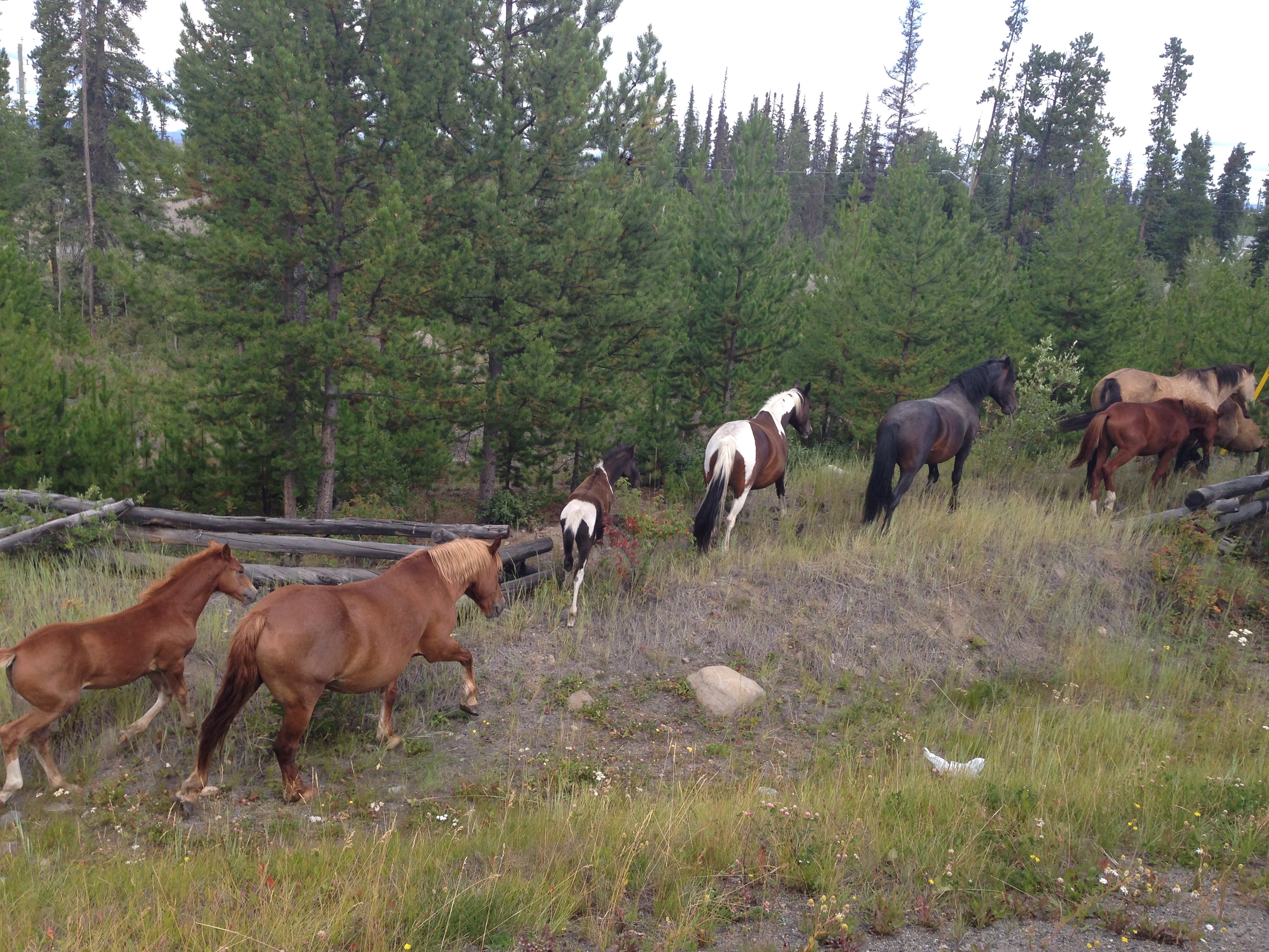 There is only road to and from Bella Coola. The only other way to access it is by Ferry. We looked into taking a ferry from there to Port Hardy on Vancouver Island a month prior but it was already booked up, so we knew we’d have to drive and then back track. We’d heard and researched very little about the drive, which is to say I’d checked to make sure there weren’t any clearance issues, and we’d talked with a few people who mentioned “the hill”; those people, btw, were surprised we’d be driving our rig down that hill. We have crossed the Rocky Mountains several times on this trip, including an intense crossing over the pass in Rocky Mountain National Park in Colorado (well, we actually crossed it twice), so we weren’t concerned. Our chat with Christoph at the ranch and some local tourist pamphlets revealed that a portion of the road (37km) to Bella Coola was also unpaved, but it wasn’t until the morning we departed that I read the unpaved portion and super steep grade of “the hill” were combined. Hmmm… I suppose it’s a fair assessment to claim that we fall on the more adventurous side of a spectrum between bold – wise.
Local volunteers finished this unpaved portion of road in 1953 because the government wouldn’t do it, and it was dubbed Freedom Road, as it connected Bella Coola to the rest of the mainland. They did a great job too considering it was originally done with just 2 bulldozers – one on either end, and they finally met in the middle a year and 2 weeks after starting. A significant portion of the road is in an avalanche/slide area so it wasn’t the safest job for them either.
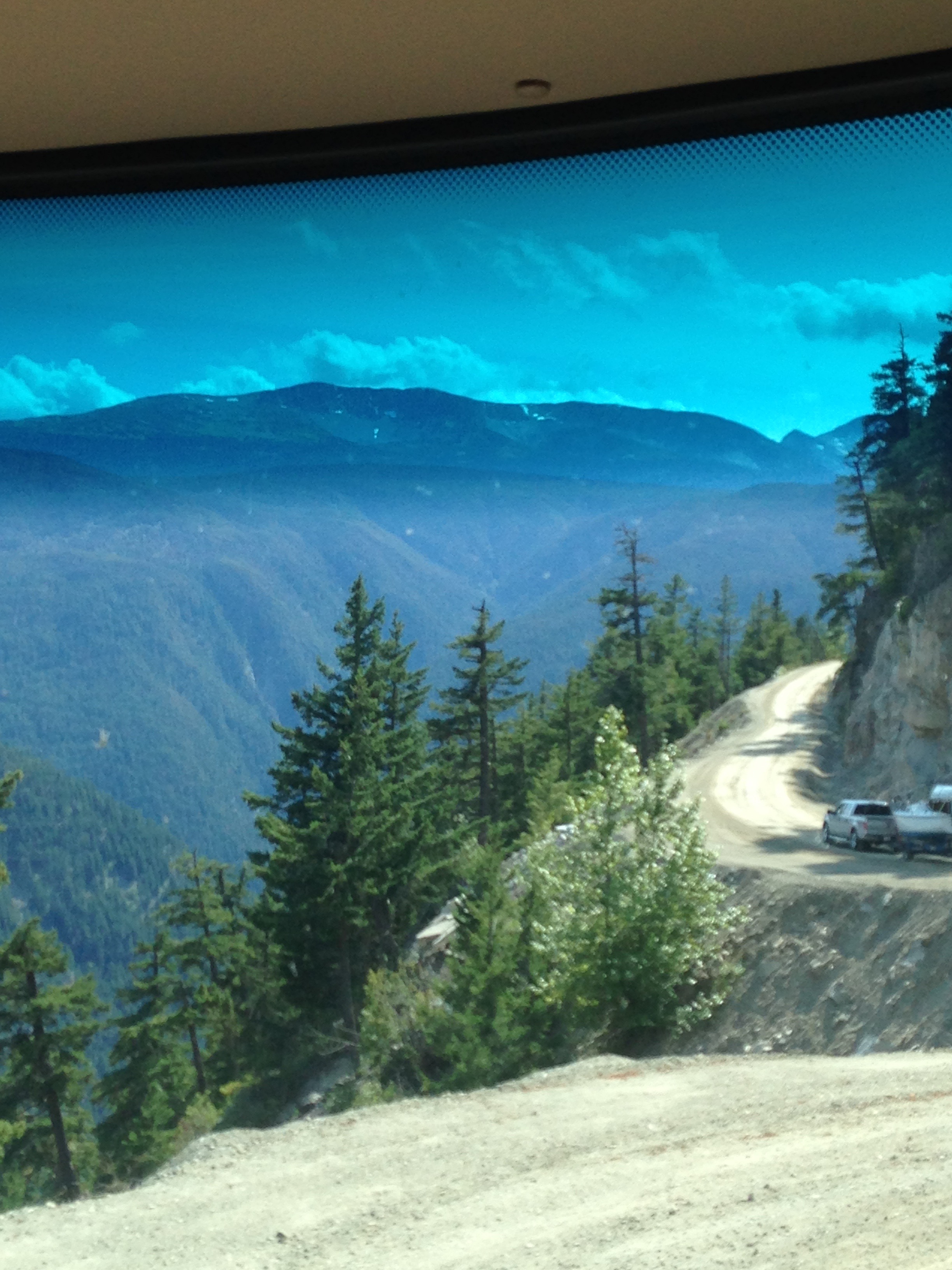 The gravel part starts off flat for several miles and about 10 minutes in we passed a family with a flat tire who needed a better jack, so we offered ours from the Jeep (the father turned out to be a police officer in Bella Coola and we later ran into them a couple more times). Having done our good deed of the day, we continued on, passed cows and horses right on the road, and eventually came to the downhill fun-zone. Our first grade sign was for 11% – if you’ve driven over passes in the US, you’ve probably noticed that most grades are 6-7% – you rarely see steeper than that. So here we were, nowhere to go but down (seriously, there wasn’t room to turn around) and jumping right it. So, Raj gears down to 1st right away but then there’s a switchback… and another hairpin turn… so he has to keep using the brakes anyway… and then there’s a sign for a 12% grade… and more switchbacks… and we’re rattling away on gravel… and then we are in the slide area and the road narrows… and a 14% grade… and more switchbacks… then there’s a freaking cliff drop-off on our left side of this narrow road… and our brakes are starting to stink… and more switchbacks… and… and OMG a 15% grade… brakes smoking… and no end in sight! There just wasn’t a break long enough to stop using our brakes! Though a mechanic would tell us not to stop and to let air cool the brakes, we found a spot barely big enough and pulled over. We stopped for over half an hour and though we risked warping the brakes, at that time we were more concerned about getting to the bottom without flying over a cliff to get there, than we were about the longevity of our brakes.
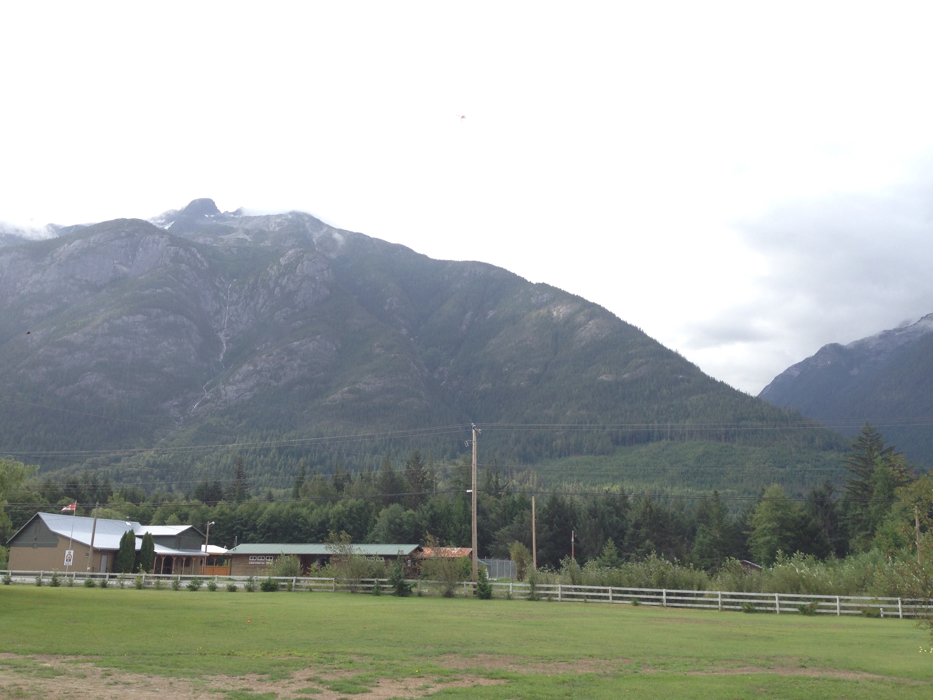
When we finally got back on the road, it was only about 10 more minutes to the bottom and another 30 or so to our campground in Hagensborg, a Norwegian founded town just 10 minutes from Bella Coola. The drive through Bella Coola valley was lovely – it’s very lush and all the homes and farms have beautiful, prolific gardens, and it’s a fairly narrow valley so the mountains on each side are quite close. The campground was right on a wide river, though our site “only” had views of the mountains on both sides. There were also apple trees everywhere, which was perfect because I’d promised Nina we would buy lots of apples to bring back to the horses on the ranch, so she had a blast picking apples every day.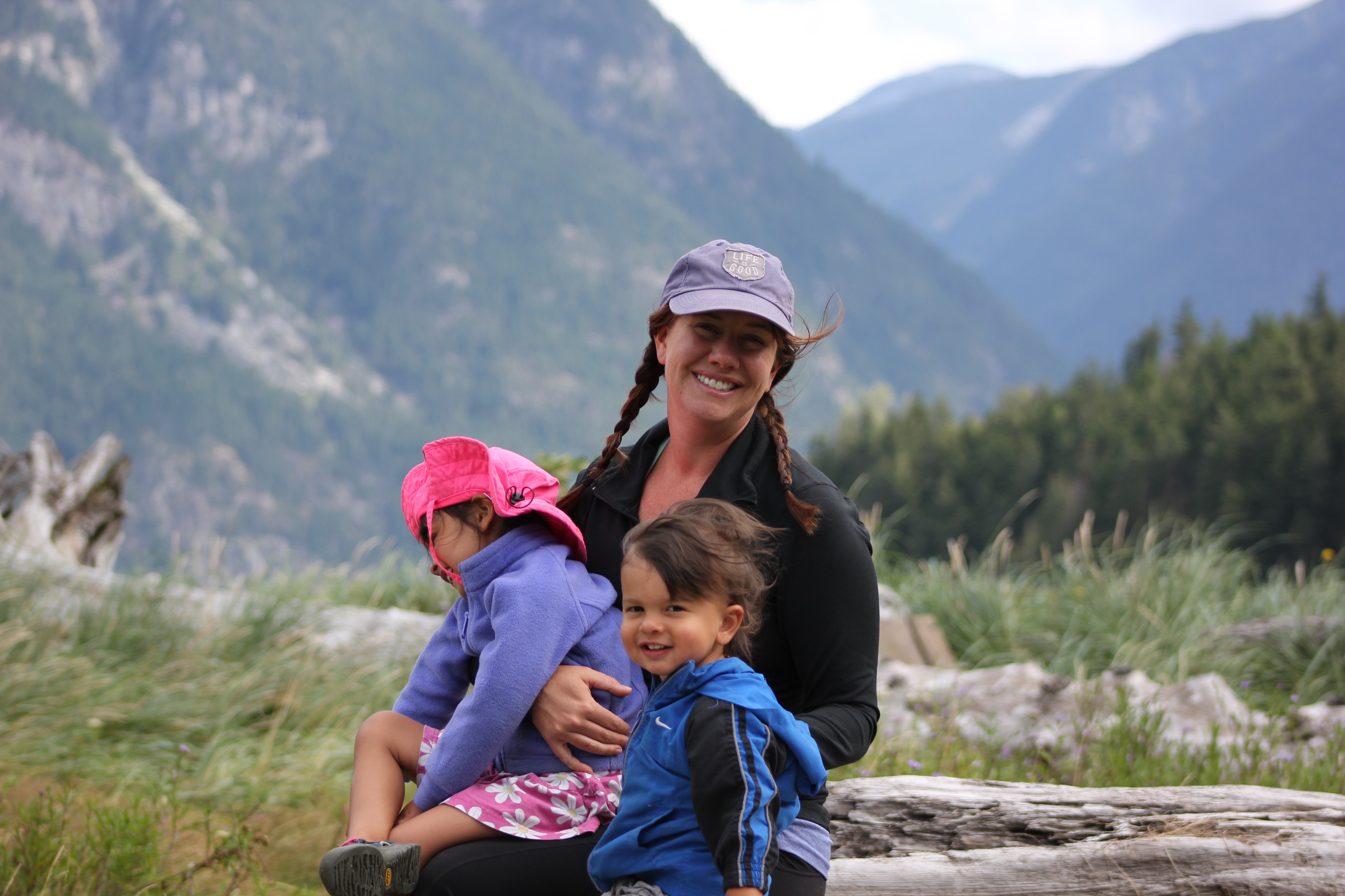
As a town, Bella Coola was a huge disappointment, but we did have a wonderful couple of days seeing waterfalls, watching seals, and buying fresh eggs and vegetables from side of the road honor-system boxes (gotta love a community built so securely on trust!). Our main adventure was a long 4×4 drive to Blue Jay Lake. We are loving our Jeep (aka Lucy) and this was a great drive to challenge her a bit more. We didn’t have a lot of information about the drive – just a basic tourist map from the visitor center – so after climbing for quite a while, only passing one vehicle on the way up, and expecting to just find a lake at some point, we were taken aback by the stunning sights we found at the top! We had panoramic views of glacier-topped peaks and blue-green waters of the fjords below – it was breathtaking! We took a couple videos but I don’t think they do it justice. It really would be difficult for most vehicles to get there, but if you have a 4×4, and you make it to this town in the middle of nowhere, BC, it’s worth a few hours to do this drive.
We had hoped to take a boat tour during our stay but it wasn’t meant to be – out of only 3 “companies” that offer charter boat tours, 2 captains were going to or participating in a wedding (small town) and the 3rd was dealing with one of his 2 boats sinking a couple days prior! We did find a great place to watch the salmon spawning though, and though we were there a couple weeks too early to see their actual run, it was fun to see them all gathered together… waiting for whatever chemical, environmental or biological signal they’ll get to start their journey upstream. This also meant we missed a likely opportunity to see bears in the stream waiting to catch them. Though some of you may find that lucky (mama, I’m talking to you), I was disappointed by our poor timing – so close, but so far!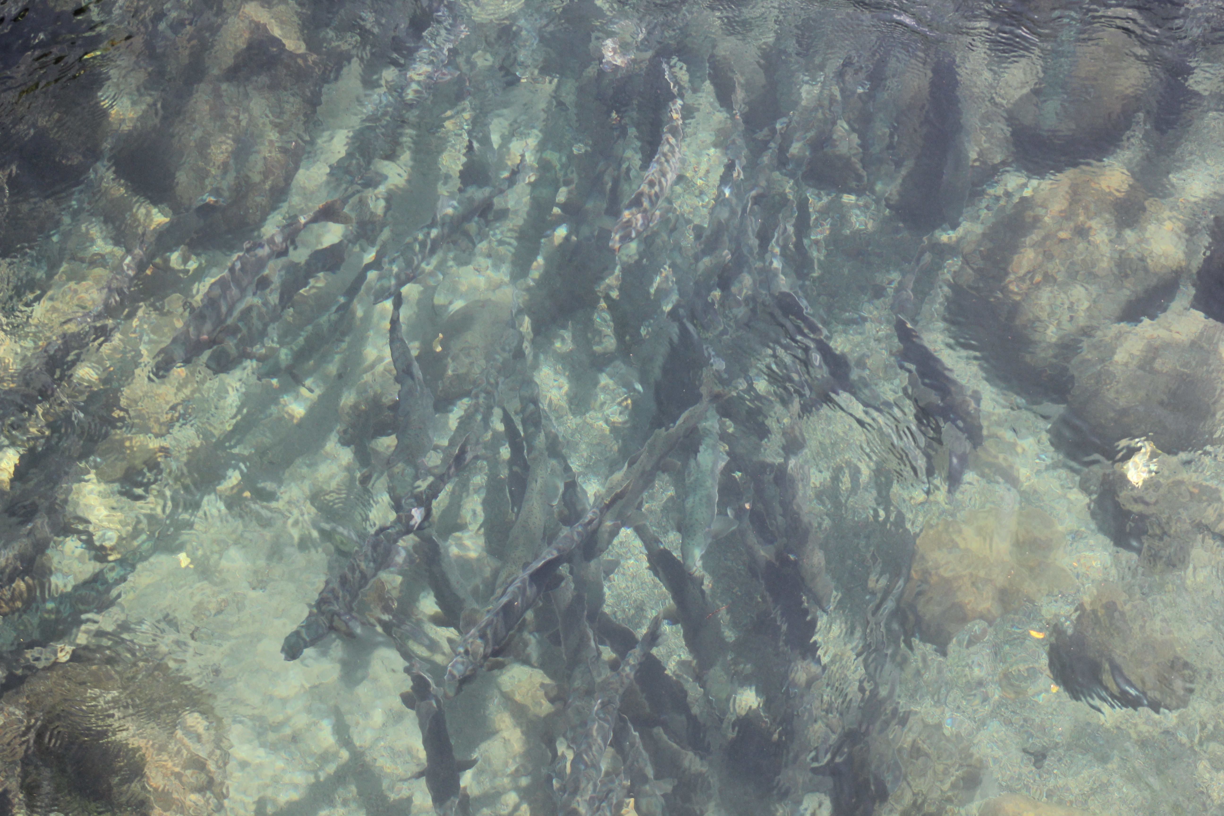
After only 3 nights, and not much else to see or do in the area, I hit up their quaint farmer’s market then we packed up for our journey back over “the hill.” Luckily, though Gypsy couldn’t quite get over 10 miles per hour, going up was easier than going down. There was only one moment when I thought we might die – while on the portion that is more like a 1 lane road, with a cliff on one side and in a slide area, another vehicle was coming downhill. In order for us both to squeeze through, we had to get alarmingly close to the edge (did I mention there’s no guard rail and the area is prone to slides???) . Being on the passenger side and looking down, I couldn’t even see the road – only the vertical drop into nothingness. There are reports that I panicked, but these reports cannot be confirmed. Needless to say, returning to the ranch was, once again, our sanctuary.
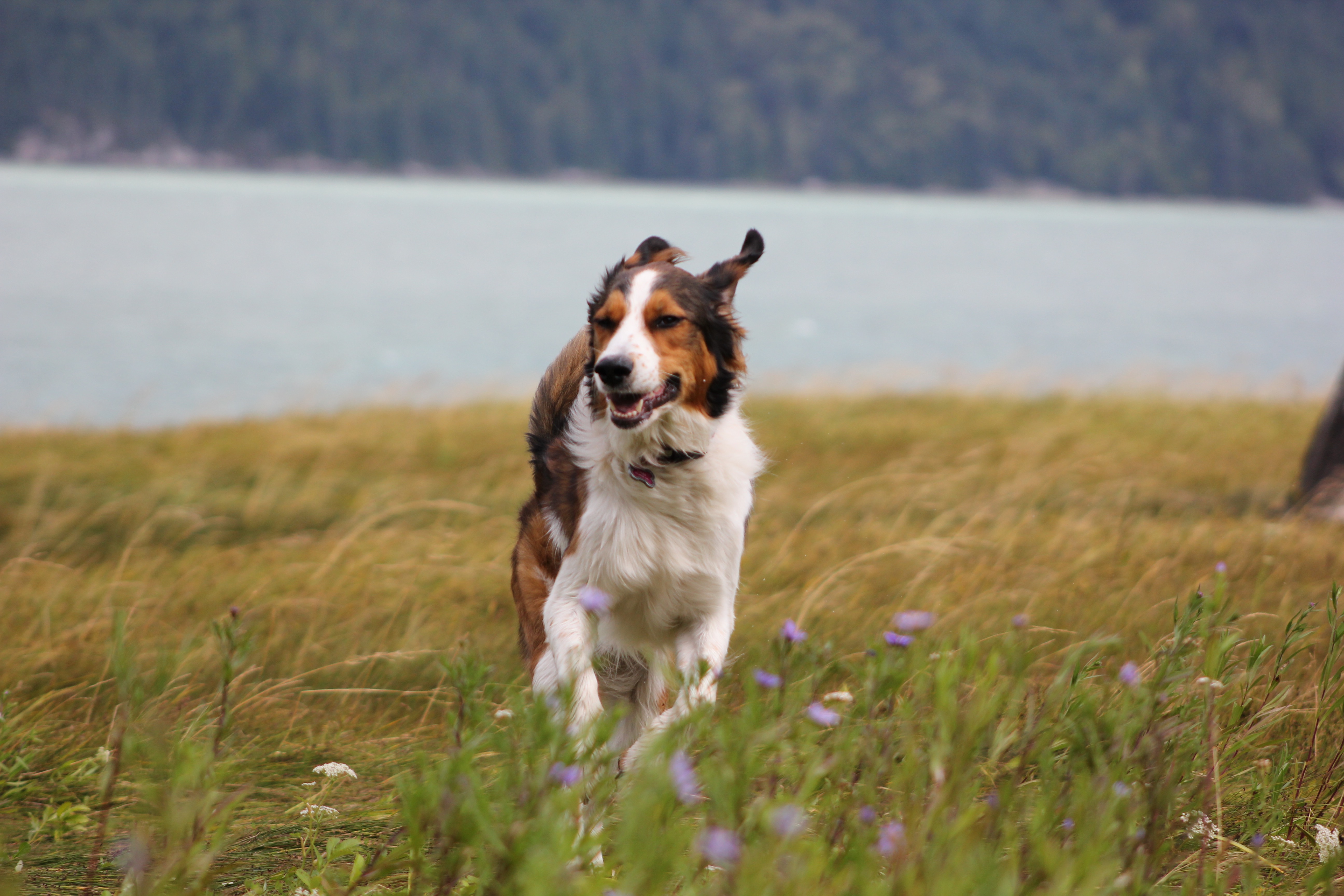
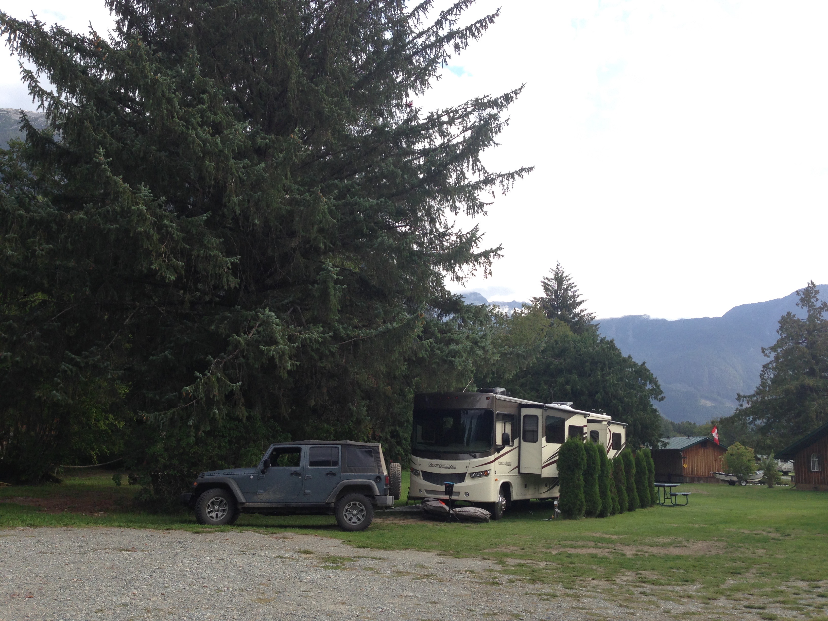 Rip Rap Campsite – 4 stars – this place was very nice. Don’t bother getting a site next to the river – you might hear it, but you won’t see it. We had a full hookup site for only $28 CAD and it was quiet, level and spacious. Management was nice and accommodating; wifi was excellent; there’s a large unfenced field they allow dogs to run in, and the location is convenient to groceries and about 15 minutes to Bella Coola.

That brake and switchback story gave me heart flutters. Glad y’all made it safely
LikeLiked by 1 person
Yeah it gave us a few too! Intense stuff!
LikeLike
Just reading that nearly have me an anxiety attack! Glad you all made it safe. I’ll check with sources later about that unconfirmed report of panic. 😉
LikeLiked by 1 person
Lol- yeah ok, I admit it- I freaked!
LikeLike